Sewer
168659341371
0 human lives at risk with all visual
inspections performed from
a safe distance
40% cost saving on average from
FTE reduction and pipe cleaning
efficiencies
900m / day inspected on average
vs 400m using conventional
methods

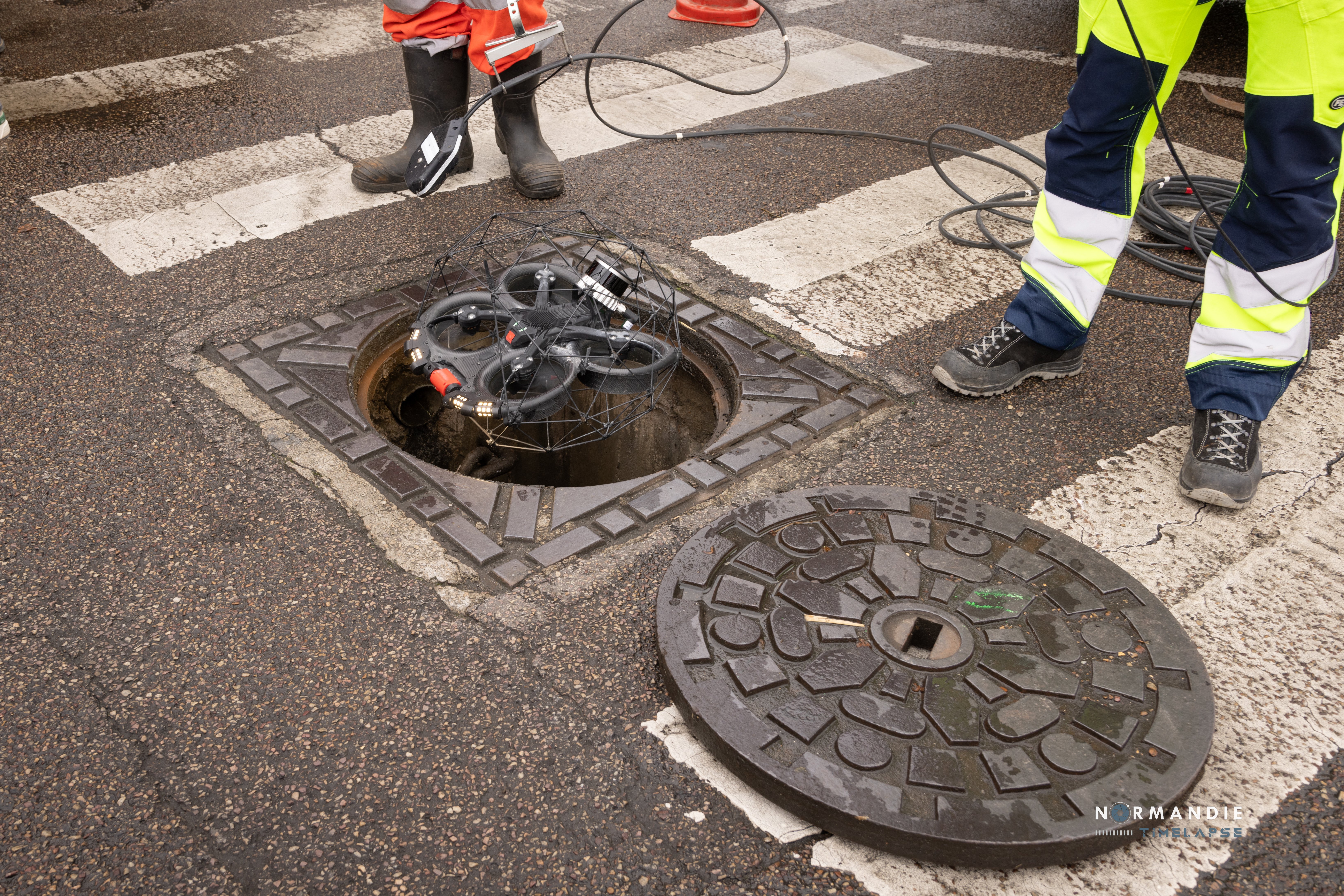
Safely inspect inaccessible places
Access sections of sewer systems through manholes and other small entry points. Quickly collect data from a safe distance, regardless of obstructions, access issues, or confined space entry procedures.
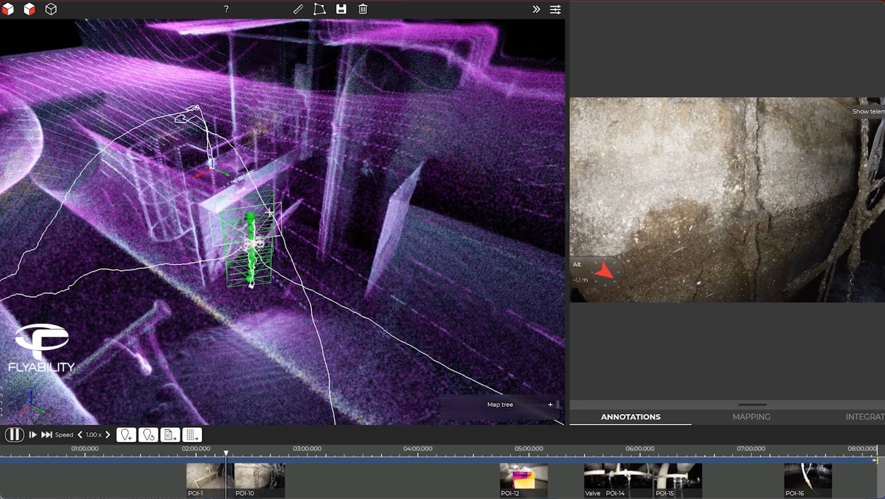
Pinpoint & document
any defects
In line with official reporting standards, you can localize the exact position of defects found during an inspection within the 3D model of your asset, for improved assessment and maintenance work processes.
Collect objective & precise data
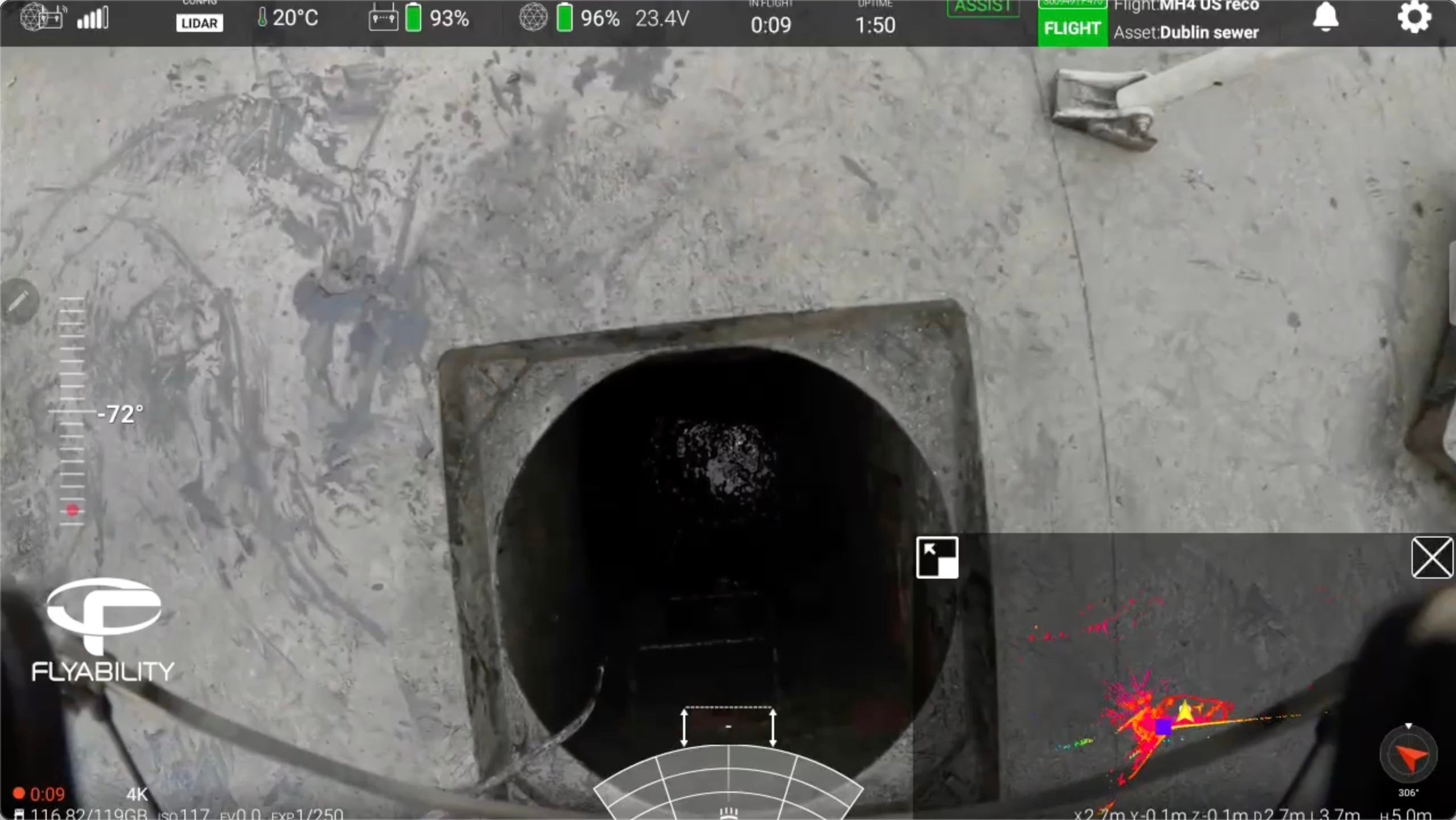
Provide a crystal clear view of the pipe and assets’ conditions with 4K video footage and centimeter-accurate scans. The Elios 3 provides greater control over data capture compared to other RVI tools such as CCTV.


Culvert inspection (cockpit view)
Use a drone to precisely localize collapses, problems with joints or seams, and buildup of debris that could obstruct the flow of water.
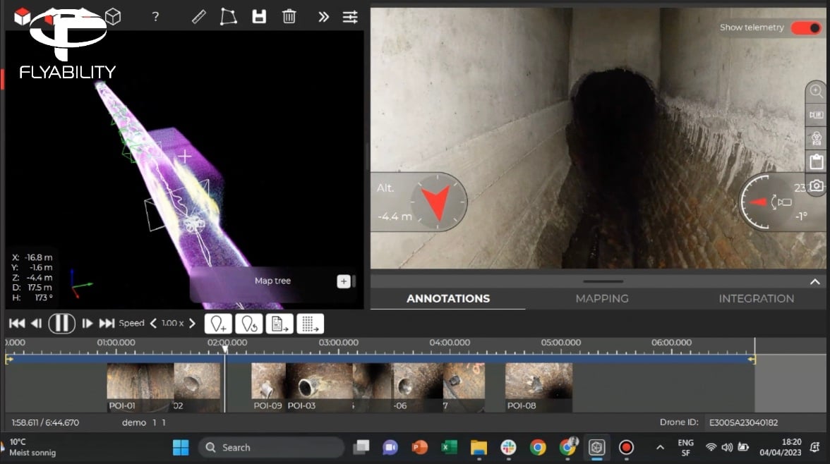
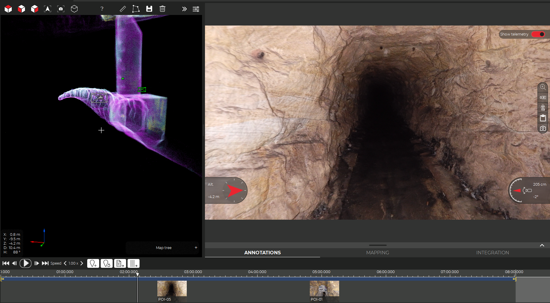
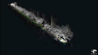
Culvert inspection (software output)
Once the mission is completed, download the drone data into Inspector, the Elios 3’s companion software. Review each flight frame by frame and precisely localize all points of interest within a 3D model of the asset.
Georeferencing of underground networks
Precisely geolocate detected networks in space and generate centimeter-accurate maps of inaccessible sewer systems.
Wastewater settling basin inspection & software output
Use the Elios 3 to rapidly assess tank condition, checking for deterioration, leaks, corrosion, etc. Conduct detailed inspections of ancillary equipment such as pumps, flanges, and joints inside the tank. Back in the office, analyze mission-recorded points of interest precisely using Inspector.
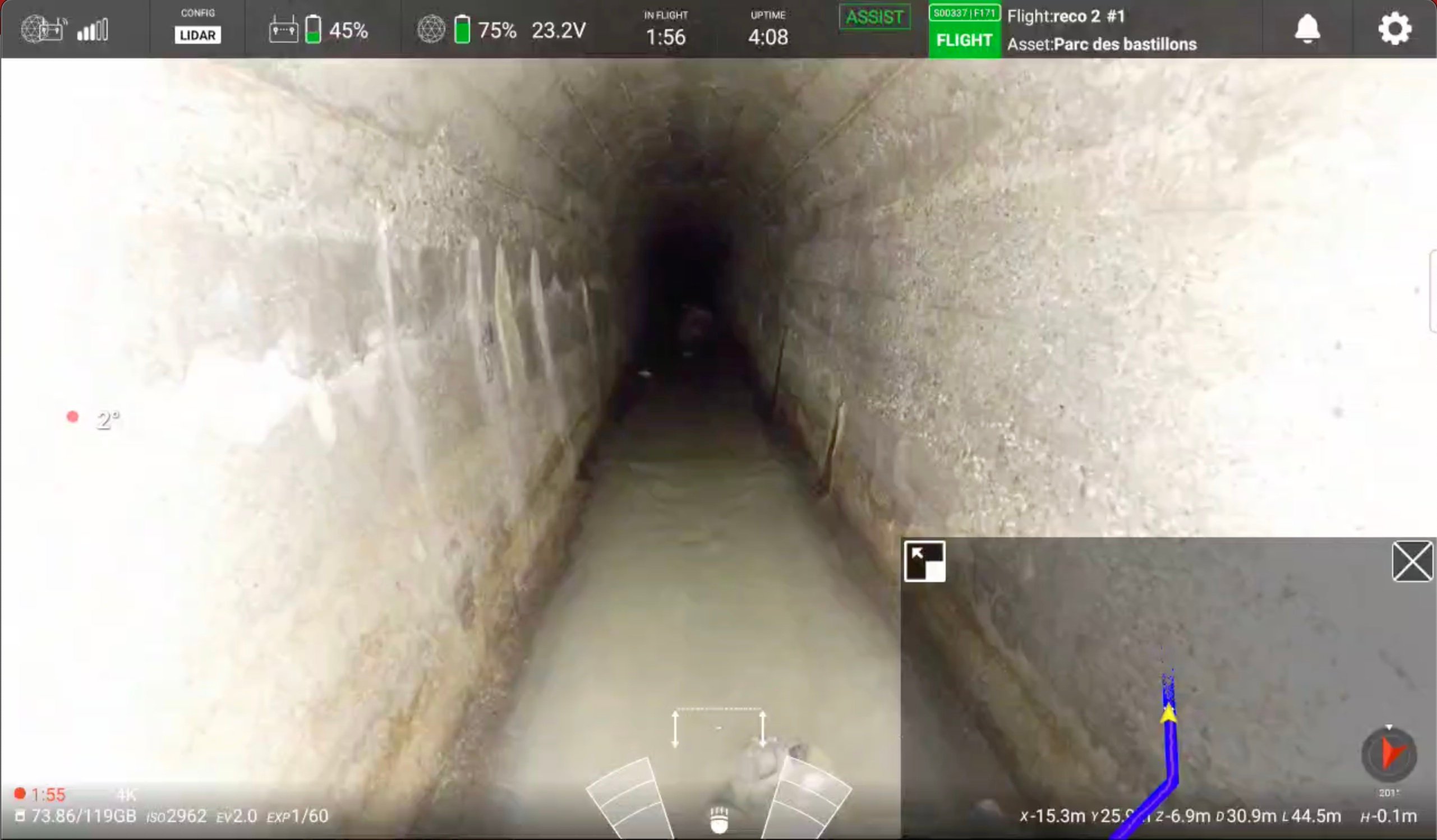
Sewage system inspection
Fly the drone inside sewer systems with diameters as small as 75 cm. Scan galleries at a pace of 900 meters per day of inspection.
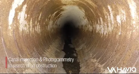
Canal inspection and photogrammetry
Use a drone to spot a collapse and make a photogrammetric model to localize and measure it in the pipe.
![]()
“
“Thanks to the Elios 3 drone, we've effectively eliminated most of the risks associated with these confined spaces.”
Julien Maj
Local Service Manager at Veolia Water
.png)