

 Oil & Gas
 Power Gen
 Chemicals
 Mining
 Sewers
Infrastructure
173843256620
Get 100% data coverage, even
in complex settings
Easily collect visual & LiDAR data
at eight or in confined spaces
Generate data 2x faster and
save on labor and equipment costs

Improved safety
Drones can be remotely operated from the ground, offering a safer alternative to traditional data collection methods.
Better data coverage
Drones can navigate at eight or in confined spaces to capture visual and LiDAR data from every angle, with precise positional accuracy.
Cost effectiveness
Drones can cover complex areas quickly, reducing the need for large inspection teams and expensive equipment.
Increased efficiency
Drones can complete inspections in less time than traditional methods, helping to reduce downtime and increase productivity.


-
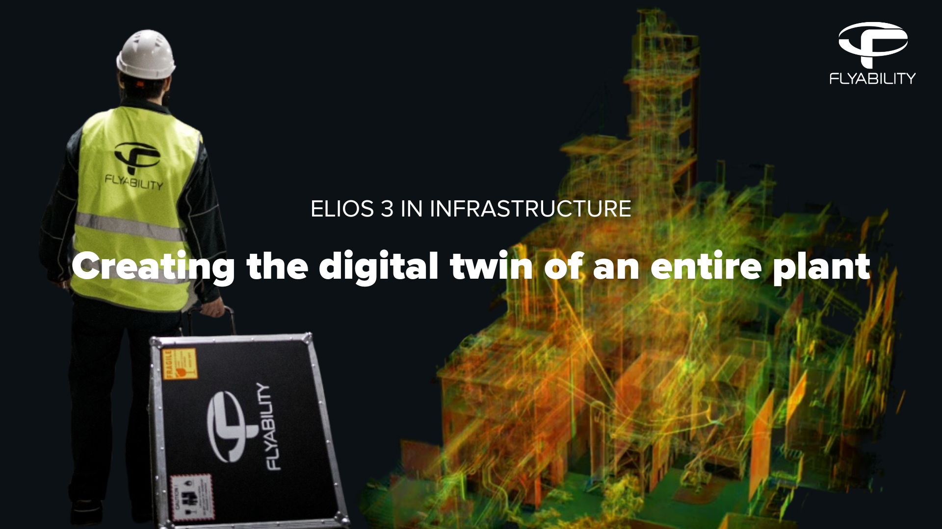

Creating the digital twin of an entire plant
Read moreMap complex industrial spaces inaccessible by conventional methods. Use the Elios 3 LiDAR data to identify the best route for retrofitting pipe systems within the current plant infrastructure and generate accurate BIM models for the new facility.
-
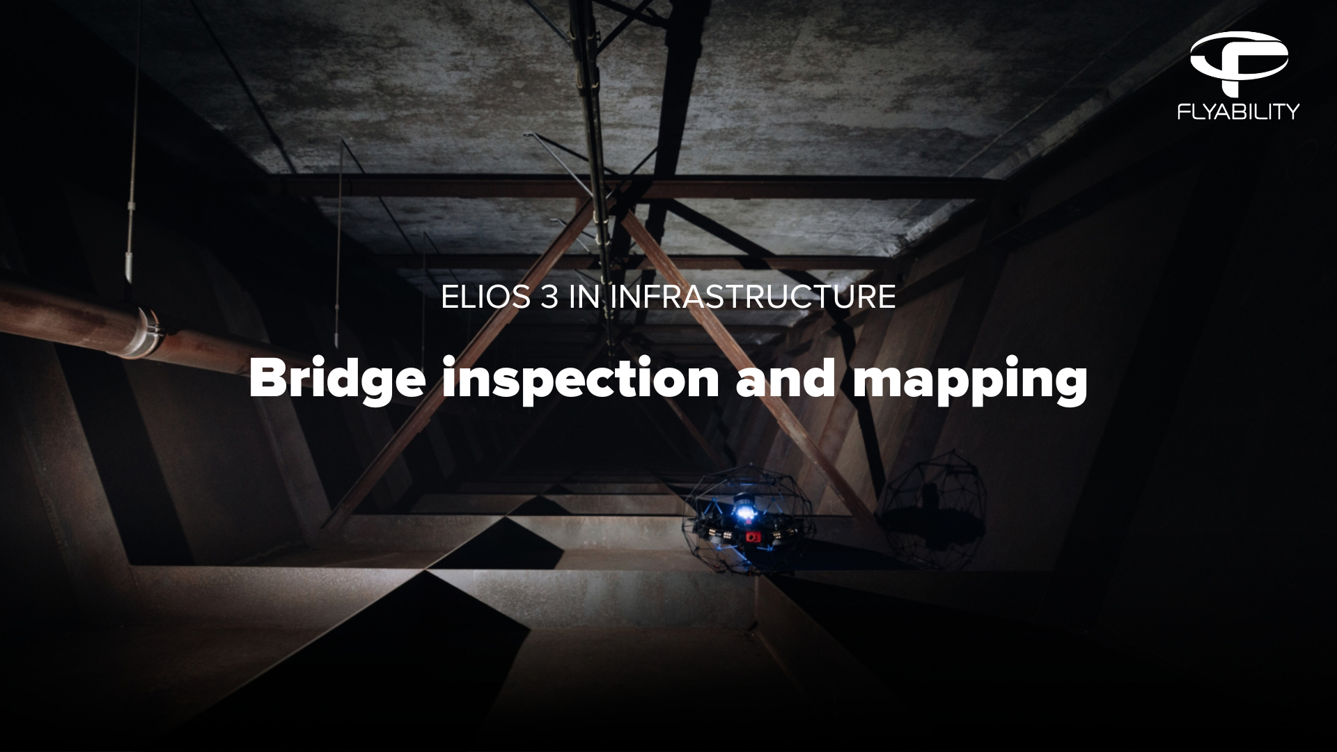
Bridge inspection & mapping
Read moreCapture highly accurate point cloud & visual data from any section of a bridge. Within minutes, uncover cracks, leaks, delamination, erosion, and other common defects before they develop into major issues.
-
 tall roof inspection.png)
Roof inspection for commercial spaces
Read moreQuickly deploy an Elios 3 to inspect and map complex roof structures. Identify and precisely localize leaks and structural issues to address them before they escalate. Alternatively, create as-built models ahead of renovation or perform volume measurements prior to decommissioning.
-
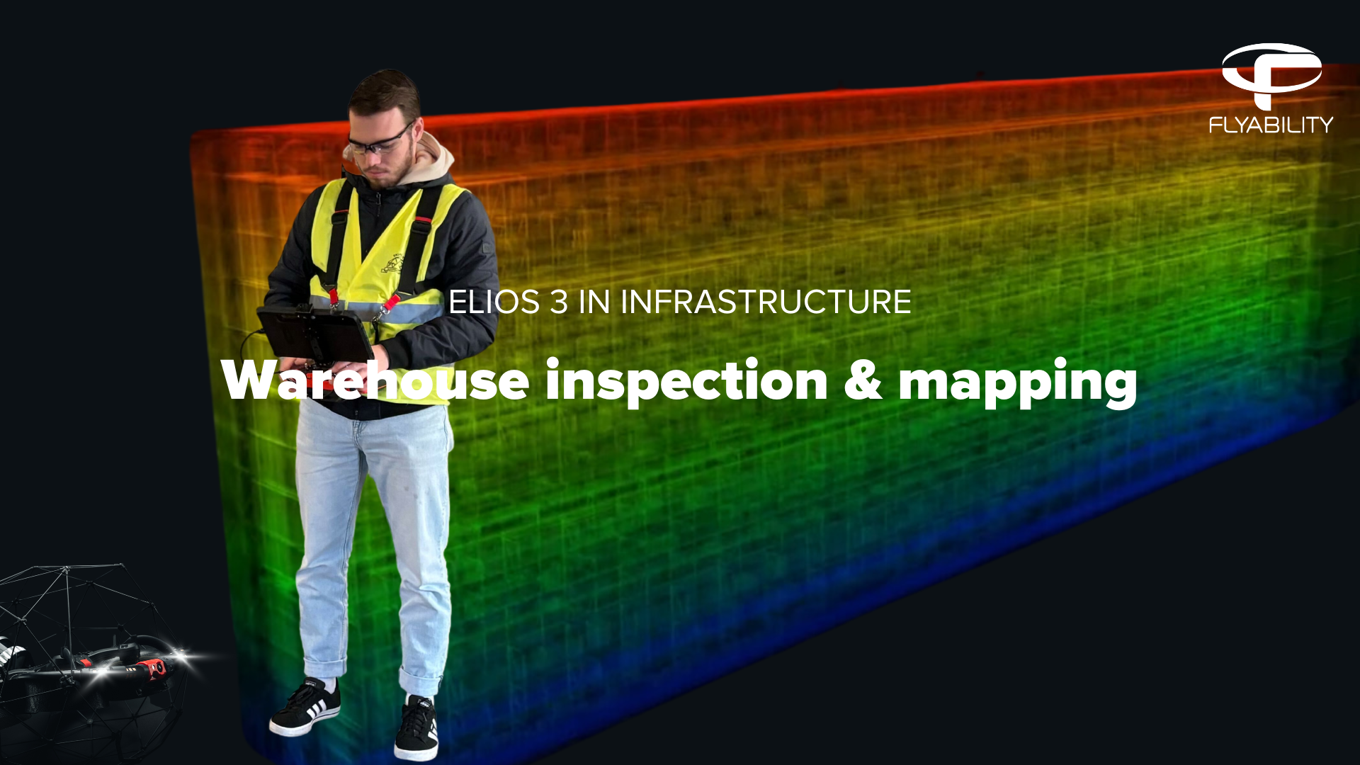
Warehouse inspection and mapping
Read moreUsing the Elios 3 platform, a one-man team captured a large warehouse in just four days, cutting inspection time by weeks. With only one lane closed each day, work proceeded as normal, eliminating downtime during the essential inspection.
-
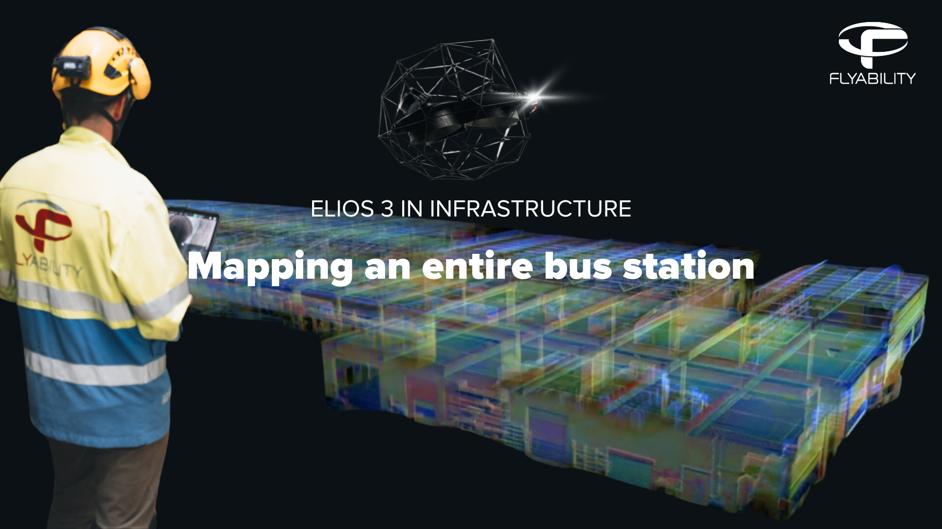
Mapping an entire bus station
Read moreCreate accurate scans of entire infrastructures with the Elios 3 Surveying drone. In this video, the Elios 3 was used to map a whole major city bus station, which helped digitalise the asset. The data was collected in just a few hours and using the drone allowed the inspectors to easily access high and inaccessible places of the station without the need for other tools.